
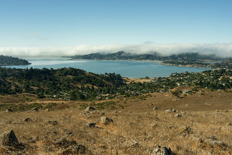
 Bay Area rock climbers love the 20-foot tall glob of granite that sits at the base of southern Marin’s Ring Mountain—that’s where they practice bouldering. And, because of its shape and color, they call the massive protrusion Turtle Rock. Also coveting the distinctive landmark are dilettante anthropologists; who head to Ring Mountain in search of possible markings left by Miwok Indians. To them, the 45-foot long boulder is appropriately named Petroglyphs Rock. But how did Ring Mountain get its name? It seems a transplanted New Hampshire dairyman, George E. Ring, once owned much of the surrounding land along the Tiburon Peninsula clear down to San Pablo Bay. And from 1895 to 1903, Ring served on the Marin County Board of Supervisors. So in 1913, when Ring died, the 602-foot tall mountain was commemorated to him by his heirs. Sixty years later, the Nature Conservancy, bolstered by ardent Tiburon residents, acquired Ring’s land and it is now part of the Marin County Open Space District. Because of its rolling terrain, close-in location and 360-degree view that includes San Francisco’s skyline, the Golden Gate Bridge, Mount Tam and, on a clear day, the mountains surrounding Napa Valley, Ring Mountain’s 367 acres are often said to be one of the most valuable parcels of real estate on Planet Earth. Ring Mountain Open Space Preserve can be reached by taking Paradise Drive east from Highway 101 to the Taylor Road trailhead.
What's In a Name: Ring Mountain

