
DORIS SLOAN WROTE the book on Bay Area geology. Really. Published in 2006, Geology of the San Francisco Bay Region tells the story of the rocks beneath our feet: what they are, where they came from, how they got here, and, in some cases, where they’re going. (You did know that Point Reyes is sneaking away in starts and stops at an average rate of nearly two inches per year, right?)
“The inspiration for this book came primarily from my students in classes on Bay Area and California geology, who demanded clear and simple explanations for a geology that is neither,” wrote the emeritus UC Berkeley professor in her introduction. The result was more than 300 pages long.
Bay Area geology is highly diverse and complex, shaped over many millions of years by a range of forces including massive tectonic plates sliding both under and past one another, and powerful volcanoes erupting on land and beneath the sea.
Marin County happens to contain some of the region’s most fascinating geologic features, many hidden in plain sight — like Franciscan chert and pillow basalt. One could drive, bike or walk right past without noticing, let alone unlocking their secrets. Yet together they help explain how Marin and the rest of the Bay Area came to be.
Below, we present a peek at four representative and revealing (not to mention impressive) geologic sites in our backyard, described here thanks in large part to the expertise of Sloan and College of Marin geology professor Steven Newton. All four locations are easily accessible and offer recreation opportunities and inspiring views to boot.
Fantastically Folded Chert
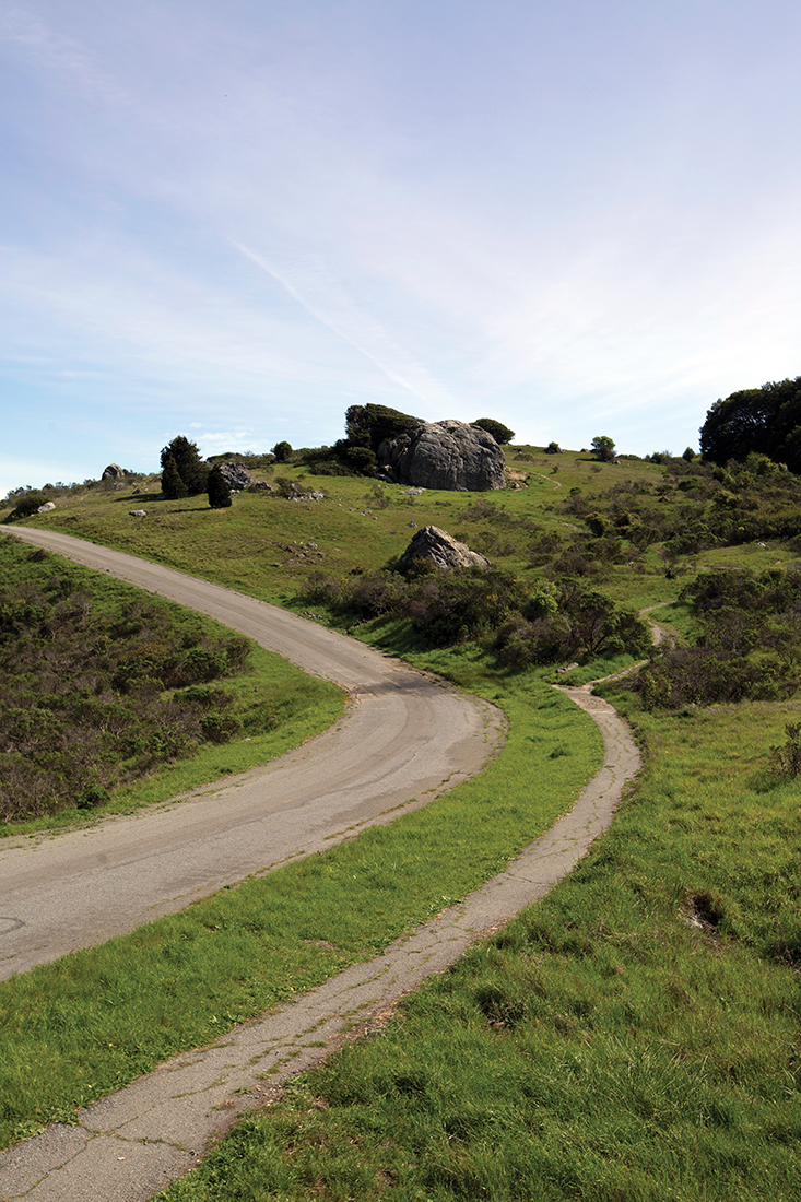
LOCATION Conzelman Road in Marin Headlands ROCK TYPE Sedimentary PRIMARY COMPONENT Silica from microfossils AGE 100 to 200 million years
FORMED LONG AGO at the bottom of the ocean near the equator, Franciscan chert is a trademark of the Marin Headlands. Its origins are quite particular. First, the tiny and intricately beautiful silica shells of singlecelled marine plankton known as radiolaria rained down on the ocean floor in incredible numbers between 200 and 100 million years ago.
This development most likely occurred in warm waters near modern-day Ecuador and the Galapagos Islands, where radiolaria are abundant. Plate tectonics brought these sedimentary materials north to our latitude around 80 million years ago, scraped them off the seafloor crust, and deposited them in the Headlands. The sediment hardened into chert, which gets its reddish-brown color from iron and manganese, although the precise origins of these elements in the rock aren’t known for certain.
Another mystery surrounding chert is exactly how it formed into the neat layers visible in the road cuts along Conzelman Road. Nor do geologists know for sure how the chert folded into such complex chevron folds without becoming compressed or disfigured, Sloan and Newton say. Instead the layers remain uniform, even at the hinges of sharp, angular folds. “That tells you that that line had to have folded when it was already solid rock,” Sloan says. “We don’t know exactly how the layers formed and solidified and then folded. It’s a wonderful, wonderful mystery. I don’t think there’s any place today where the ocean sediments have been sampled and you see this happening.”
Geologists travel from around the world to visit and study Franciscan chert in the Marin Headlands — a “world-class exposure,” in Sloan’s words — but you can also find other good examples in the East Bay at Coyote Hills and Mount Diablo and in San Francisco at Twin Peaks.
High-Grade Metamorphic Rock
LOCATION Ring Mountain in Tiburon ROCK TYPE Metamorphic PRIMARY COMPONENTS Muscovite and garnet AGE 140 to 160 million years
RING MOUNTAIN OPEN Space Preserve is a hidden gem, although not hidden to geologists. Newton likens its unique landscape to a “melted ice-cream topography,” as the rough and jumbled rocks here recall melted “rocky road,” with nuts and marshmallows oozing to the surface.
Or, he says, to employ another kitchen metaphor, “This is like taking part of the seafloor crust, sticking it in a Cuisinart, and dumping it out. It’s all incredibly mixed up.”
The term “high-grade metamorphic rock” refers to rocks formed under particularly high pressures and temperatures, and Ring Mountain is home to a wide variety of rocks formed under different variations of these conditions. In very close proximity are rocks in shades of blue and green, glittering with mica, covered with dark blue or green crystals, or sprinkled with reddish garnets. “You can walk from one to another and see what it should take a mile to walk between different grades of,” Newton says. “It’s bizarre to get these chunks that are so disparate from each other all mixed up.”
So-called blueschist metamorphic rocks are considered highly unusual in and of themselves, existing in only a few places in the world. Typically when blueschist is created by plate subduction it is subsequently destroyed by being driven back down into the earth. “What’s different here is that about 80 million years ago, this got coughed up and became part of California, as the Farallon Plate that was subducting had a little hiccup and scraped all this seafloor crust off,” Newton says. The violence of that process is responsible for the incredible variety of metamorphic rocks we see at Ring Mountain today.
Pillow Basalt
LOCATION Petaluma–Point Reyes Road in Nicasio ROCK TYPE Igneous/Volcanic PRIMARY COMPONENTS Iron and magnesium AGE 200 million years
YOU WOULDN’T EXACTLY want to rest your head on one, but these volcanic rocks earn the “pillow” moniker from their distinctive rounded shapes. When you’re zooming past at 50 miles an hour, as hundreds of motorists do every day headed to and from the coast, this vertical wall (exposed when a hillside was removed to make way for Petaluma–Point Reyes Road) may not look like much. But up close the rocks take the form of stone grapes protruding from a mountain.
The story of how they got there is even more intriguing. Pillow basalt, which also makes up the striking sea cliffs near the lighthouse at Point Bonita, forms when volcanoes erupt and magma flows underwater. Each lobe, or “pillow,” flows for a few seconds, cools and then hardens, before another lobe breaks through and continues the process. While the exterior of a lava flow essentially flash-freezes when it hits seawater, the interior takes longer to cool and continues to push forward until it too “freezes” in place. But the lava’s got to go somewhere, so it breaks through as a new flow. Gradually the various flows stack atop each other and end up as something like what we find here, by the side of the road in Marin, 200 million-or-so years later.
Like the chert on Conzelman Road, this pillow basalt originated on the ocean floor near the equator and was transported here in a similar fashion over a similar time period. In fact, a narrow ribbon of chert is visible in the wall at one location. This would’ve taken thousands or maybe millions of years to accumulate, Newton says, yet the much-larger formations of basalt above and below it could have formed over the course of just a few hours.
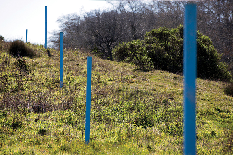
Earthquake Fault Offset
LOCATION Bear Valley Visitor Center in Point Reyes TYPE Transform plate boundary PLATE NAMES Pacific (west) and North American (east) AGE 109 years, one month, 20 days
THE UNITED STATES Geological Survey announced in March that the likelihood of a massive earthquake hitting California sometime in the next three decades is even higher than we thought — not because anything changed with the earth, but because our understanding of quakes has improved. One of the most likely faults to trigger such a shaker is the infamous San Andreas, albeit in its southern section centered near the Mojave Desert. The northern section through the Bay Area could still slip, but locally probabilities are higher for the Hayward and Calaveras faults.
The San Andreas’ 1906 rupture is considered the gold standard in California quakes, essentially dwarfing everything that has followed over the last 109 years. For visceral evidence of just how powerful it was, and for insight into one of the most important forces in recent Marin County and California geologic history, nothing beats a visit to the Earthquake Trail at Point Reyes. The highlight of the trail is a reproduction of a section of fence that was cleanly displaced a whopping 16 feet in a matter of 45 to 60 seconds. In other places, the land moved as much as 20 feet when the Pacific Plate, containing Point Reyes, lurched north past the mainland North American Plate, continuing a long march of some 300 kilometers over the past 25 million years.
Sounds crazy, but not after you spend some time on the Earthquake Trail. “This is definitely one people will want to go to,” Newton says. “It’s nice and quiet. Spend a moment meditating on the violence of the earth and what it will do to us in the future.”
This article originally appeared in Marin Magazine’s print edition under the headline: “Under our Feet.”
