
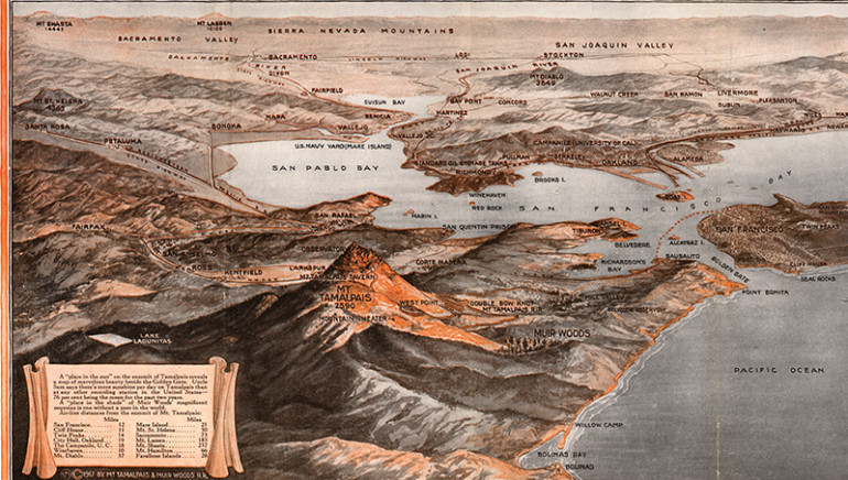
TAKE A GOOD look at the above rendering before attempting to answer a few questions. What you’re looking at is a 1917 view of the Bay Area (it was called “Bay Country” back then) that appears on a 1925 brochure archived at the Anne T. Kent California Room of the Marin County Free Library. Here are the questions:
- Is Stinson Beach on the map?
- Are the Standard Oil tanks in Richmond, so visible now, on the map?
- Are San Quentin Prison, the Mountain Theatre and all of Marin’s 11 incorporated cities on the map?
The brochure in which the map appears was promoting the Mount Tamalpais and Muir Woods Railway, which between 1896 and 1930 ran from downtown Mill Valley to the top of Mount Tamalpais and then, beginning in 1907, down into the then recently dedicated Muir Woods National Monument; it was known as “The Crookedest Railroad in the World.”
The answers:
-
In a way, yes: at the time, Stinson Beach was called Willow Grove.
-
Yes.
-
Yes, yes and yes (except Novato).
