
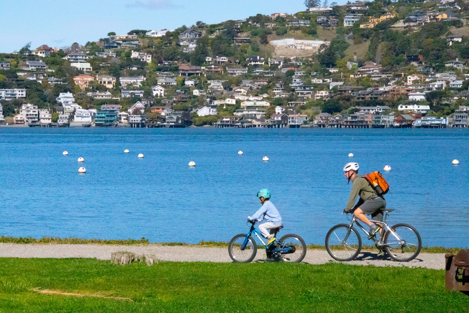
The sport of bicycling starts early for many Marinites. Legions of Marin kids ride daily to school, and some join high school mountain bike teams to race locally and statewide. (Kentfield’s own Kate Courtney was crowned world champion in 2018 and competed in Tokyo Games in 2020.) Commuters ride weekdays to the ferry landings in Larkspur, Tiburon and Sausalito or across the bridge to jobs in San Francisco and beyond. And road and mountain cyclists congregate in downtown San Anselmo, Fairfax, Sausalito and Mill Valley’s Lytton Square area on weekends, clustering like colorful superheroes at local coffee spots, comparing their shiny (often pricey) steeds and trading notes before heading out for day long adventures on Marin’s roads or trails.
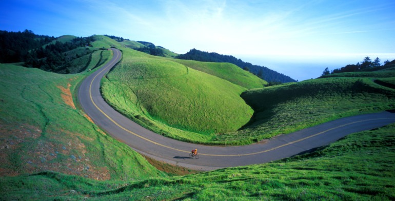
It’s no wonder biking is so popular in Marin County. We have an abundance of gorgeous country roads, family-friendly paths and off-road routes that make it a bona fide pedaling paradise. Every weekend, especially in spring, bicyclists stream here from all over the Bay Area to enjoy epic rides through our grassy headlands, backcountry ridges, redwood forests, oak woodlands and cliff-hugging coast. The road biking options are wide and diverse; for mountain bike and gravel bike enthusiasts, hundreds of miles of unpaved access roads and single-track trails entice knobby tired escapes into nature. It’s so much fun to ride here, it’s downright addictive.
Ready to go riding? The Marin County Bicycle Coalition (MCBC), an advocacy group, produces a detailed bike trail map that is available in laminated form with MCBC membership or at many local bike shops and bookstores. But we’ve profiled some of our favorite mountain, road and family bike rides in Marin County here.
Before you head out, however, keep in mind that some of the rides we describe bring you far into Marin’s nature wonderland, so be prepared with plenty of water, cell phone, spare tubes, tools and pumps, and be on the lookout for poison oak, yellow-jacket wasps, ticks and rattlesnakes (bobcats, coyotes and mountain lions are also present but rarely seen.) Happy trails!
Mountain Biking
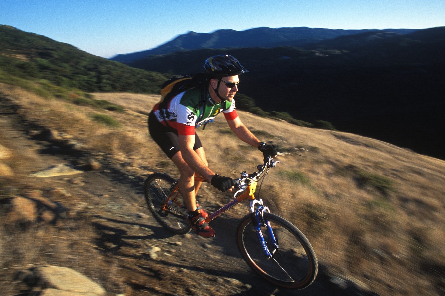
Marin is the birthplace of mountain biking for a good reason: The off-road riding is simply epic. In the 1970s, a few local bike racers like Joe Breeze, Tom Ritchey, Gary Fisher and Charlie Kelly experimented with custom-built bikes, first modifying old heavy, cruiser bikes with stronger drum brakes and clusters of multiple gears that could handle the rigors of trail and dirt road riding and racing. They soon built lighter and stronger, custom-welded frames equipped with cantilever brakes, and the modern mountain bike was born. Fast forward five decades and, today, Marin is a premier destination for mountain bikers from all over Northern California and the world, drawing legions of riders each weekend.
Camp Tamarancho
Difficulty: Advanced
Length/elevation gain: 10.8 miles/1,407 feet
Amenities: Restrooms
Highlights: Marin’s most extensive and challenging single track-trail system
Watch for: Poison oak, deer, red-tailed hawks, ticks and rattlesnakes
This private (annual or day pass required) mountain bike trail system on Boy Scout-owned land in the hills above Fairfax features challenging rock gardens and wide Mt. Tam views on the Wagon Wheel Trail and sublime forested turns down the Endor Flow Trail. Starting in Fairfax, you ride a couple of miles up Iron Springs Road to access the clockwise-direction trail system. Tamarancho is mostly single-track trail and best suited for experienced mountain bikers (beginners should not ride here.) Longer rides outside Tamarancho are accessible via the loop trail. Note: Tamarancho trails are closed during rainstorms to prevent erosion. Day, annual and family passes are available online at boyscouts-marin.org.
Loma Alta to 680 Trail
Difficulty: Advanced
Length/elevation gain: 1.9 miles/848 feet
Amenities: None
Highlights: Wide views of the upper Ross Valley and Olema Valley, Mt. Tamalpais, San Francisco Bay and bayside cities in the distance
Watch for: Red-tailed hawks, bobcats, ticks and rattlesnakes
Lofty Loma Alta (1,592-feet in elevation) is one of Marin’s hidden treasures. This scenic dirt road ride in a Marin Open Space preserve has incredible spring bloom and wide views of southern Marin. Start on Glen Drive near White Hill School in Fairfax and climb the Smith Ridge Fire Road up to the peak. A few sections are relatively steep (but short) and may require some walking. Less than a mile before the summit, the 680 Trail (2.6 miles) heads east (downhill) into beautiful Sleepy Hollow but, before you turn to connect to the trail, don’t miss the amazing 360-degree views just a few hundred yards ahead. A cattle gate allows access to the steep fire road ascent to the summit for even more stellar views and access to longer rides into Lucas Valley.
Marin Headlands Loop
Difficulty: Intermediate
Length/elevation gain: 7.8 miles/1,279 feet
Amenities: Restrooms in Tennessee Valley parking area
Highlights: Open and brushy terrain, Pacific Ocean views, weekend crowds
Watch for: Ticks, rattlesnakes, bobcats, red-tailed hawks, coyote, deer and an abundance of wildflowers in spring
Park along Rodeo Lagoon on Bunker Road in the Marin Headlands and follow the Rodeo Valley Trail to the Miwok Trail. A moderately steep ascent brings you to the scenic Old Springs single-track trail, which descends to Tennessee Valley’s Miwok Stables (local courtesy requires bikers to walk bikes past the horses). Loop back on the dirt Marincello Road to the Bobcat Trail for the return to Bunker Road to complete the loop.
Marin Watershed Loop
Difficulty: Intermediate
Length/elevation gain: 14.3 miles/1,445 feet
Amenities: Portable toilets at Phoenix Lake and Sky Oaks Ranger Station, and restrooms and water at Lake Lagunitas
Highlights: Stunning scenery on Mt. Tamalpais’ north side
Watch for: Deer, red-tailed hawks, merganser, great egrets, acorn woodpeckers, bald eagles, coyotes and bobcats
Park in the town of Ross or, if space is available, at the small, free parking lot for Natalie Coffin Greene Park, located at the end of Lagunitas Road. (The park is one of several gateways to the huge expanse of watershed lands and lakes of the Marin Municipal Water District.) Ascend the Phoenix Lake Fire Road (1 mile, 207 feet elevation gain) past small and scenic Phoenix Lake. the district’s oldest reservoir, circa 1905. To take on the popular Three Lakes Loop, continue up Shaver Grade to the paved Sky Oaks Road via Five Corners. Ride the broad, lightly trafficked road for beautiful views of Mt. Tam’s north side to Lake Lagunitas’ parking and picnic area (restrooms and water available.) Ascend the short access road along the dam’s wooden spill ramp to an easy-going trail along the lake’s southern shore. About halfway around the lake, turn right (east) on the Lakeview Fire Road. A steep but short ascent then descent brings you to Eldridge Grade, which offers a fun and winding drop through redwood forest back to Phoenix Lake.
Old Railroad Grade
Difficulty: Intermediate
Length/elevation gain: 6.8 miles/2,123 feet
Amenities: Water and restrooms at East Peak
Highlights: Outstanding views of Southern Marin, San Francisco Bay, Muir Woods and the Pacific Ocean
Watch for: Red-tailed hawks, turkey vultures, ticks, rattlesnakes and coyotes
A classic dirt-road ride up Mt. Tam’s south side starts in Mill Valley’s West Blithedale canyon, following the former route of the popular Mt. Tamalpais & Muir Woods Railway (the self-described “Crookedest Railroad in the World”) that whisked tourists up the mountain from 1896 to 1929. Winding up the grade, which never exceeds 6% in steepness, the route brings you through dense redwood forest and narrow canyons to wide views of Mill Valley from the brushy southern slopes of chaparral and manzanita. Climbing higher past the famous “double bowknot” turns, the route continues to the West Point Inn, once a railroad inn and restaurant and now a hikers’ club that offers rustic cabins for overnight stays. This is wonderful spot to take a break, rest on a picnic table and take in the views of southern Marin, San Francisco Bay, Muir Woods and the Pacific Ocean. Continue on to Mt. Tamalpais’ 2,571-foot high East Peak (Marin’s highest peak) and you’ve achieved one of most memorable and scenic rides in the Bay Area. Descend the way you came using only gravity power. (Note: For a longer loop, at the West Point Inn turn right on the Old Stage Road and descend to Pantoll Ranger Station. Connect with the Deer Park and Coast View trails, which lead to Dias Ridge Trail near Muir Beach and the climb up the ridge to Mill Valley’s Panoramic Highway. City streets lead you back to town.)
China Camp State Park Loop
Difficulty: Beginner/intermediate
Length/elevation gain: 8.7 miles/792 feet
Amenities: Restrooms, picnic grounds, historic shrimp fishing village and camping
Highlights: Well-maintained single-track trail, views of San Pablo Bay and abundant wildflowers
Watch for: Ticks, rattlesnakes, deer and red-tailed hawks
A loop ride on the well-maintained trails at this bayside park on San Rafael’s Point San Pedro starts at one of three parking pullouts on North San Pedro Road. Follow the mellow Shoreline trail (perfect for beginner riders) to the Bay View Trail, which ascends gradually into the park’s oak woodlands to the Oak Ridge Trail. An easy-going descent brings you back to the shores of San Pablo Bay. The park has numerous picnic areas and a historic Chinese shrimp fishing village that are perfect spots for post-ride picnics and relaxation. A China Camp State Park day-use trail pass is required and available from ticket kiosks located at main trailheads. Some parking areas in the park also require a day-use parking pass.
Road Biking
Paradise Loop
Difficulty: Beginner/intermediate
Length/elevation gain: 9.2 miles/315 feet
Amenities: Restrooms and water near Blackie’s Pasture, and waterfront cafes in downtown Tiburon
Hightlights: Views of Richardson and San Pablo bays, Sausalito and Angel Island
Watch for: Car traffic on narrow, winding Paradise Drive
This ride can be made long or short, but either way, it’s a Marin County classic. The heart of the ride is the part that’s in the middle and southern end of the Tiburon peninsula. Park in the large, free lot at Blackie’s Pasture and follow the Tiburon Historical Trail multiuse path along Richardson Bay to Tiburon Boulevard and downtown Tiburon (a good spot for a cup of coffee and a snack). Continue on Paradise Drive, a lightly trafficked road that follows the scenic east side of the Tiburon Peninsula. Stop at Paradise Park for a picnic and to soak in the serene views of San Francisco Bay and the East Bay hills. At Trestle Glen, turn left and head back to Blackie’s Pasture. A longer, more challenging version of the Paradise Loop (26 miles, 1,174 feet elevation gain) starts in Sausalito, heads on the multiuse bike path to Mill Valley, over Highway 101 to Blackie’s Pasture, Tiburon Boulevard and Paradise Drive to Greenbrae and Corte Madera. Follow Camino Alto or the path along the base of Horse Hill and Highway 101 to the multiuse path back to Sausalito. This route is very popular, so it’s best to ride on weekdays or early mornings.
West Marin Loop
Difficulty: Intermediate
Length/elevation gain: 37 miles/1,520 feet
Amenities: Cafes in Point Reyes Station that are a perfect for a mid-ride rest stop
Highlights: Sheer pastoral beauty of West Marin
Watch for: Automobile traffic that can be fast and frequent on these roadways (flashing safety lights on the back and front of your bike are recommended and ride on the shoulder when possible).
Start in downtown Fairfax and ride northwest on Sir Francis Drake into the Olema Valley and the rolling pastureland and redwood forest of West Marin. Follow Sir Francis Drake northwest over White Hill and the Brown Bridge until it connects with Nicasio Valley Road. Take a right and head northwest on Nicasio Valley Road to Nicasio Reservoir. When you meet the Pt. Reyes-Petaluma Road, head left (west) and ride to Pt. Reyes Station. Head south on Highway 1 through Point Reyes Station into Pt. Reyes National Seashore. At Olema, you’ll meet back up with Sir Francis Drake Boulevard, which leads back to Fairfax past Taylor Park, Lagunitas, Forest Knolls, Woodacre and Olema Valley.
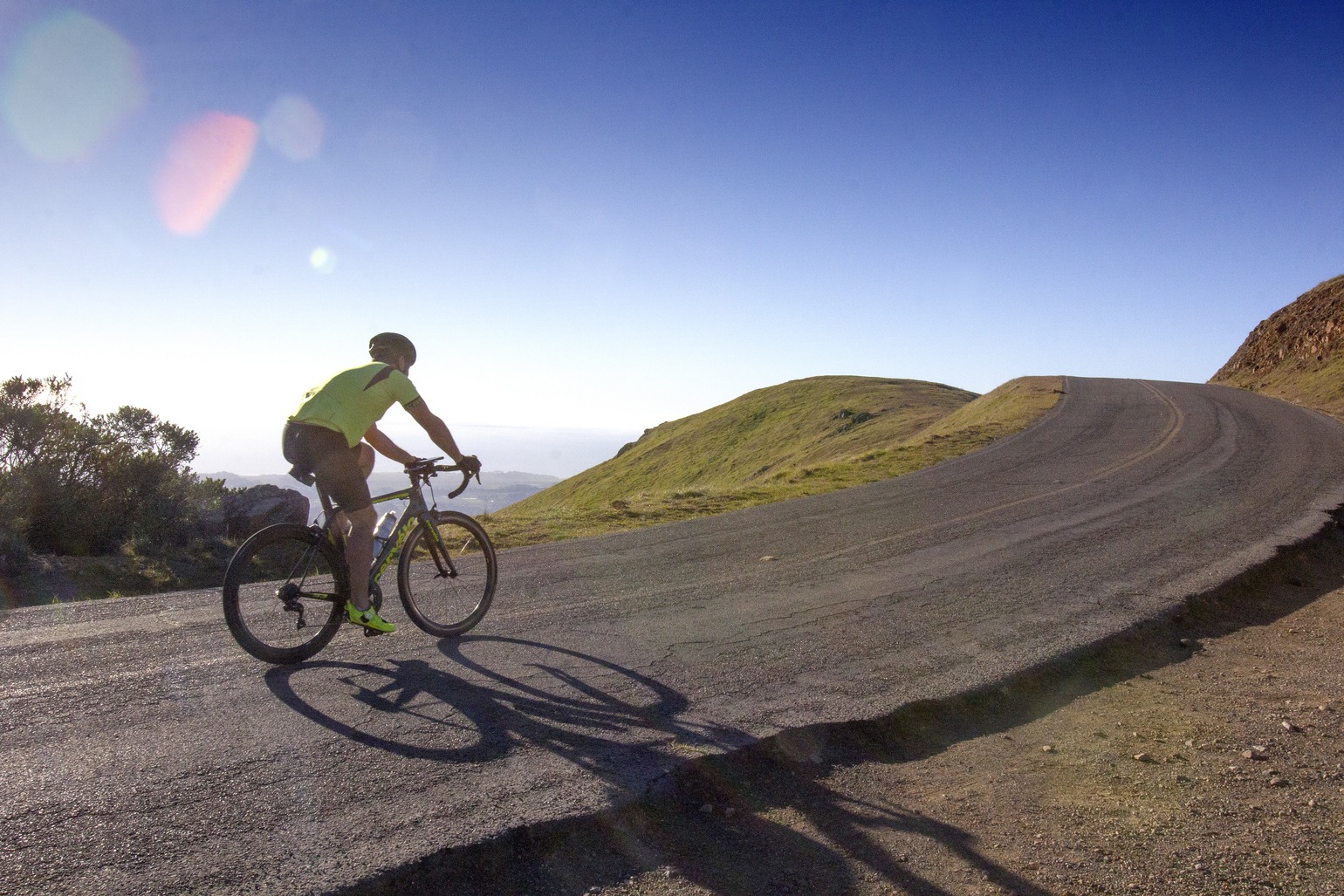
Mt. Tamalpais Loop
Difficulty: Advanced
Length/elevation gain: 31.5 miles/3,700 feet
Amenities: Numerous cafes and brewpubs near the route’s finish line offering well-deserved drinks and food
Highlights: Killer climbs, stunning Pacific views
Watch for: Car traffic along the entire route
Not for the faint of heart, this epic road ride features a whopping 3,700 feet of climbing through some of Marin’s most beautiful terrain. Start from downtown Fairfax and head up the narrow, winding Bolinas-Fairfax Road, a steady climb into the pristine, forested watershed lands on the mountain’s north side. Passing the immaculate fairways and greens of the Meadow Club Golf Course and Azalea Hill, you descend to the sparkling waters of Alpine Lake, a watershed reservoir. Crossing Alpine Dam and passing the trailhead to the waterfall-laced Cataract Trail, you begin a major ascent through dense redwood forest to the Ridgecrest Boulevard, the picture-perfect roadway (often featured in car commercials) that winds through grassy hills overlooking Bolinas Lagoon, Seadrift and the Pacific Ocean. At Rock Spring, you intersect Pantoll road and descend to meet the Panoramic Highway and the start of a thrilling roller-coaster route back to Mill Valley. Turn east (left) at Four Corners and descend to Mill Valley’s Miller Avenue, where you can ride to Camino Alto up and over Corte Madera Ridge back to Fairfax via Corte Madera, Larkspur, Kentfield, Ross and San Anselmo.
Family Biking
Tiburon Bike Path and Angel Island
Difficulty: Easy/intermediate
Length/elevation gain: 2.6 miles, plus an optional 5.4- or 3.7-mile extension/level elevation, or 407 or 315 feet
Amenities: Restrooms and water at Blackie’s Pasture
Highlights: Views of Richardson Bay, Sausalito, birdlife, playing field, children’s playground
Watch for: Off-leash dogs, pedestrians, runners and other cyclists
Nearly level and breathtakingly scenic, the Tiburon Historical Trail multiuse path runs along the shallow waters of Richardson Bay and is an ideal route for families with young children. Park at the parking lot at Blackie’s Pasture and ride past the restrooms, playing field and playground located along the path. Divert onto San Rafael Avenue to visit another excellent children’s playground, the Tiburon/Belvedere playground near downtown Tiburon. For a longer day, time your ride with the Angel Island ferry, which brings you to Angel Island State Park. A paved 5.4-mile perimeter road with a 407-foot elevation gain offers an easy circumnavigation on the island, with numerous spots to stop for a bay-view or beachside picnic. For a more challenging dirt road ride around the island, ascend 0.7 miles on the steep access road near the Immigration Station to the island’s Fire Road Loop (3.7 miles, 315 feet elevation gain).
Phoenix Lake to Deer Park
Difficulty: Easy/intermediate
Length/elevation gain: 8.1 miles/TK feet
Amenities: Portable toilets at Natalie Coffin Green Park and water on Phoenix Lake Road
Highlights: Lake views, redwood forest and wildflowers in spring
Watch for: Red-tailed hawks, great blue heron, great egret, coyotes and bobcats
This dirt and a paved street loop is perfect for younger mountain bikers seeking to improve their skills. Start in Ross and ascend the Phoenix Lake Fire Road to Shaver Grade for a gradual climb to Five Corners. Descend to Deer Park in the bike-friendly town of Fairfax for a waffle cone of organic ice cream at the Scoop before heading back on city streets to Ross.
Samuel P. Taylor Park Bike Path
Difficulty: Easy
Length/elevation gain: 5.3 miles/164 feet
Amenities: Restrooms, water, picnic areas in Samuel P. Taylor State Park
Highlights: Dense redwood groves and pristine riparian habitat along Lagunitas Creek
Watch for: Black-tailed deer, raccoons, skunks, coyotes, bobcats, gray foxes and river otters
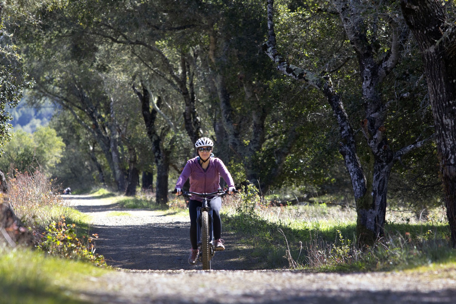
Known as the Cross Marin Trail, this out-and-back, family-friendly trail follows the right-of-way of the historic North Pacific Coast Railroad along Lagunitas Creek, through Samuel P. Taylor State Park, and beyond into the Golden Gate National Recreation Area lands. You ride through a diverse forest of redwoods, oak, madrone, live oak, bay laurel and Douglas fir. In spring you see abundant native wildflowers such as milkmaids, buttercups and Indian paintbrush. The ride starts at Shafter Bridge outside the park (limited street parking available), follows an easy-going, out and back route on a gravel and paved path to the Platform Bridge Road at Tocaloma (street parking also available here for rides in the opposite direction).
Plan and Track Your Ride
These techie tools are designed to help bikers get the most out of every ride.
Strava
One of the best cycling apps for recording your ride, Strava shows your speed, distance, route and other metrics, such as elevation. And, you can follow your friends rides, too!
Mtbproject
This crowd-sourced mountain bike guide offers detailed off-road biking routes and information.
Trailforks
The app provides a useful trail database that can help mountain, gravel and e-bikers plan their rides.
Post-Ride Food and Libations

Biking, beer and pub grub go hand in hand after a long ride. Here are a few casual post-ride destinations to enjoy with your fellow cycling kinfolk that are conveniently located near popular bike routes.
Creekside Pizza & Taproom
Go for burgers, pizzas, salads and craft beers, with access to a lovely outdoor setting in the town’s Creekside Park. San Anselmo
Junction Pizza
Order a pie by Pizza Hacker and enjoy a cold beverage the expansive beer garden. Mill Valley
Gestalthaus
Keep it simple with brats and bikes. Fairfax; @gestalthausfairfax on Facebook
The Lodge
Refuel with breakfast burritos, chicken taquitos, salads and more in a historic roadhouse with picnic tables and cowboy tents out back. Fairfax
Split Rock Tap & Wheel
This hybrid bike shop and cafe serves pizzas, sandos and fresh craft beer on tap — the perfect place to talk shop. Fairfax
More from Marin:
- Lucasfilm’s Doug Chiang Talks Designing Star Wars Live-Action, Galactic Starcruiser and Galaxy’s Edge, and Life in Marin
- Wildlife Hikes In Marin: Top Trails to Take, Animals to Spot and What You Can Do to Help Protect Them
- Celebrating the Earth This Month With a Nod to Marin’s Rich History of Environmental Activism

Ben Davidson is a Bay Area native and spent his early years in Mill Valley. He is a former Sunset staff travel writer and also contributes to Diablo, Westways, VIA and 7×7.com. He has lived in Fairfax since 1997.
